Sustaining Williams Woods: a pursuit from Acadia Roher on Vimeo.
Monday, June 14, 2010
Wednesday, March 17, 2010

Thursday, November 19, 2009
Mystery at Chimney Rock Mountain


Sometimes I feel like one of the Hardy Boys in my role as an amateur detective...
One intensely hot August day in 2007, I sat on the fresh-swept porch of the Williams House and dug out photo after photo from a a cardboard box that was somewhat shredded from the gnawing of mice over the years. Babies, cows, riverbeds--images of lost years and lives and landscapes came into view. In one picture, several women with indistinguishable faces posed on a rocky precipice. Where was this? Why were the women dolled up in heels and hairdos in such a seemingly rugged place?
A possible solution came soon thereafter during a trip to the Huntsville Historical Society. I was rifling through a book on the history of St. Paul and recognized a similar outcrop in another photo. This time, however, a new set of faces beamed up in black and white. The caption informed me that the bluff was atop Chimney Rock Mountain, located just south of the White River from Williams Woods. According to tradition, the site was known as a lookout for the first settlers. It became a popular picnic spot for church and community gatherings. In St. Paul's heyday, a resort was planned for the top of the mountain because the spring was said to have healing powers. Unfortunately, the benefactor died soon after a road was constructed to the top and grass seed was sown. Plans did not continue, and the decline of St. Paul in the 1930s saw to it that most development was stymied for the long term.
The bluff at Chimney Rock Mountain is now part of the Ozark National Forest and can be reached on foot. Anyone up for an adventure?
Monday, August 17, 2009
FT^2: Flagging Tape and Ferocious Ticks
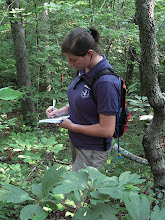
 The first challenge was to mark the property boundary of Williams Woods. A professional/official survey would cost over $6,000 and involve technology way out of my league. Bob Cross, President of the Ozark Society, volunteered for the job with his personal GPS unit. Although his markers are not perfectly accurate, nor are they accepted by the county as official survey, his work was a big help in my study. In later months, we will mark the property boundary with higher accuracy GPS units for GIS mapping and it was good to find out what kind of terrain and other potential obstacles might exist.
To determine property boundary lines, Bob looked at the deed description, which says things like "
 the Northwest Quarter of the Northwest Quarter (NW 1/4), containing 40 acres, more or less, being in Section 33, Township 14 North, Range 26 West." The Public Land Survey System, set up after the Northwest Ordinance of 1787 through the vision of Thomas Jefferson, carved the United States up into rectangular "townships," each 6 miles square. Each township was divided into 36 "sections," which were further subdivided into corners to ease surveying. The Arkansas territory was surveyed beginning in the early 1800s... this was no easy feat. Teams of men slogged through Delta swampland and steep, forested Ozark hills with primitive survey equipment of the day-- long chains, compasses, and log books.
 As you can imagine, error was inevitable. When GPS became accessible to the public in the 1990s, property boundary surveys became much more accurate. A landowner might find that his property lines were "off" by sometimes 60 feet or more when corrected using GPS. At Williams Woods, several fence lines were 20 to 30 feet over from the line given by our GPS unit. This inconsistency might be explained by decreased accuracy of the GPS unit because of tree cover, or perhaps the barbed wire fence was erected using an older, less accurate survey technique. I guess we'll find out when we return with high-accuracy GPS units.
 Currently, each corner of the property is marked with a wooden stake, and flagging tape marks our path about every 10 feet. The total distance around the property was over 5 miles. We came to cliff faces and streams and downed trees... but it was important to continue in a straight line so we did our best! The journey made it easier to imagine what it must have been like for the original surveyors in the 1800s. Hard. Very.
Tuesday, July 7, 2009
Trail? What trail?
 There WAS a trail here, before the January ice storm. Now it's easier to bushwhack through the forest than to crawl through all the downed trees on the trail.
 Every five feet is an over, under, through, or around. Anyone want to come out with a chainsaw?
 Bob rests, looking forlornly out over the valley. We were hungry and tired, with a long slog ahead of us.
Wednesday, July 1, 2009

Tuesday, June 30, 2009
Project Proposal
Nitty-gritty details on the project:
http://docs.google.com/View?id=dgtjx87d_6z26v6bdd
http://docs.google.com/View?id=dgtjx87d_6z26v6bdd
Subscribe to:
Posts (Atom)